
Trek with the Marmots

The Best of Popular Bhutan Trekking Trails combined into one giant Adventure:
1. Mt. Jumolhari Trek,
2. Naro Trek,
3. Yaktsa Trek and
4. Druk Path Trek
The routes are least trodden so there are hardly any tourists and while this is a challenging Trek, it is also all the more spectacular with magnificent views of the Snow Capped Himalayas and the best yet amongst all the trekking trails of Bhutan.
Introduction
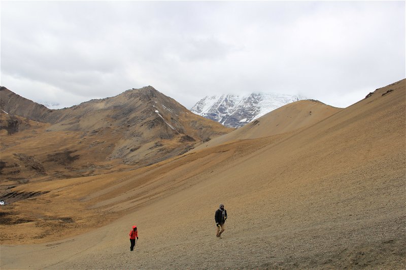
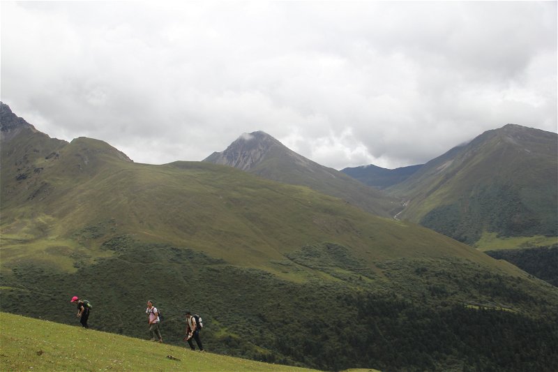
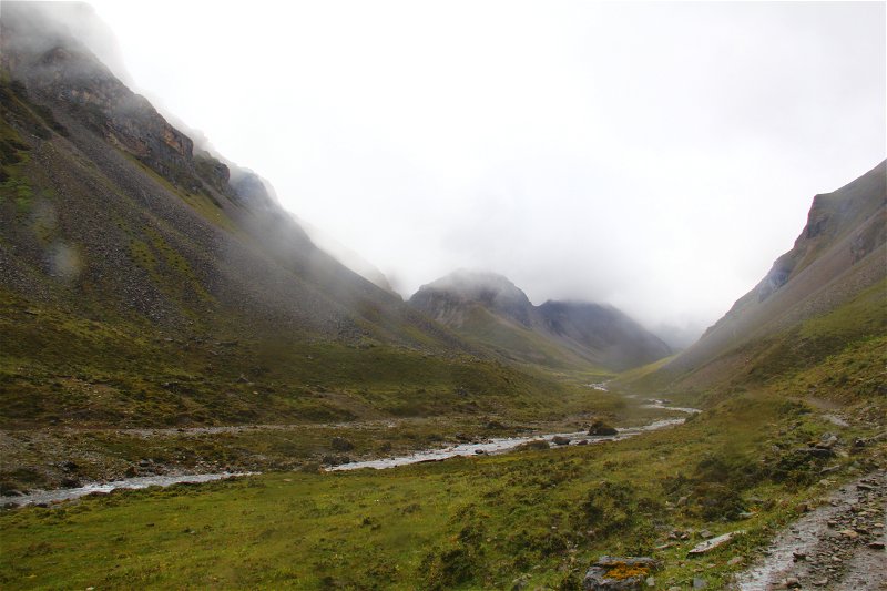
A marmot here, a yak there, a herd of blue sheep here, a mountain lake below, an exotic flower here, a swift-flowing stream there, a bridge here and a mountain ridge beyond that. This is the pattern of the eight-days trek that took a group of us across the vast wilderness with altitude that stretched between 2,100 metres and 5,200 metres above sea level.
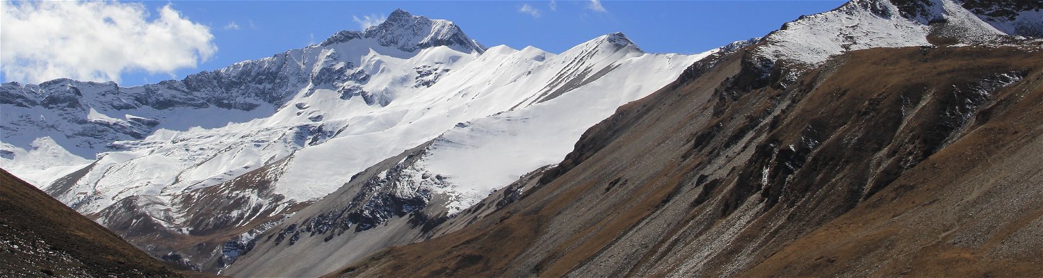
The Jomolhari Combo trek is all about exploring the Jigme Dorji Wangchuk National Park, the second largest National Park of Bhutan covering an area of 4,316 square kilometres with an altitude range of 1,200 metres in the south to 7,314 metres in the north. The park is home to numerous species of animals many of which are endangered or extinct in other parts of the world. They include the Royal Bengal Tiger, Snow Leopard, Takin, Blue Sheep (Pseudouis Nayaur), Musk Deer (Moshcus Chrysogaster), Himalayan Black Bear, Marmot (Marmota Himalayana), Red Panda (Ailurus Fulgens) and several species of pheasants. More than 300 species of medicinal plants can be found in the park.
The trek that spans the entire Jigme Dorji Wangchuck National Park in northern Bhutan took us across 26 bridges, 12 lakes, and six mountain passes. But the trek has a thousand-fold more to offer than just the mere numbers. The virgin wilderness stretches far and wide, ultimately tapering off into frozen peaks rising into the sky. One could see at least six mountain summits from the route. It all seems formidable and unconquerable but when the will to explore takes hold of the human spirit, the two little legs can take one beyond the horizon.
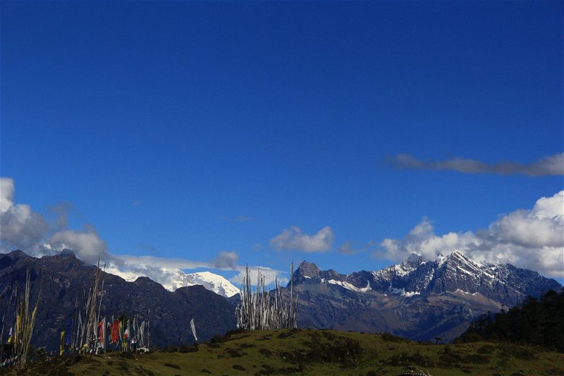
The Trek starts with the Yaktsa Trek Trail in Paro valley, diverting towards the regular Jomolhari Trek, following the Naro Trek and finally merging with the Druk Path Trek that ends at Thimphu.
What is the Good Season for this Bhutan Trekking?
Bhutan is located in the upper interior part of the Himalayas with mountains as high as 7800 m above sea level. This adventure involves trekking on the ridge of rising mountains to these high Himalayas, and mostly the trail is between 3800 – 5200 m above sea level and the campsites are between 3800 – 4280 m. It will be extremely cold in winter and moderately cold in summer. Therefore this Trek is good for the month of April, May, September, Oct and November, moderately good for the month of March and August. Due to extreme cold and the frozen ice in winter it’s not good for the month of January, February and December and also not advisable for the month of June and July due to rain and bad weather.
Where to Stay While Trekking?
A dedicated team lead by the trekking leader, certified chef, horseman with horses and enough helpers to ensure a comfortable trekking experience, will accompany you through out the trek.
Normally, it takes about 6-7 hours of walk between the camps and you will usually reach your campsite around 4 – 5 o clock in the evening. 2 times tea and snacks will be served on the way, in the morning and after noon with hot lunch at some good location, most of the time with spectacular views of the Himalayas. A hot tea or porridge will await you at the campsite. Hot water bags, hot meals and comfortable mattresses will also be waiting for you in your A – shaped sleeping tent with good quality sleeping bags.
A separate toilet tent will be pitched nearby at a dedicated location and, on demand shower tents can also be provided at a small additional cost.
The trekking leader will brief you every morning about the next day’s schedule.
Check for the following Essential Trekking Gears While Trekking in Bhutan
During the Trek
- Clothes: Waterproof jacket and pants. You really don't need thick heavy clothes. As always, trekking in layers is better.
- Bag pack with rain cover for bagpack
- Water bottles (at least 3 liters total capacity)
- Baseball cap (the sun is strong at all elevations)
- Hiking poles (lessen the impact on your joints)
- Sunglasses (essential when you cross snow line)
- Trekking shoes: A pair of lightweight-waterproof hiking boots is a must. Break them in beforehand
- Winter hat
- Winter gloves
At the Camp Site:
- Head lamp with extra batteries
- A pair of Camp shoes too.
- Thermal underwear and can be useful in the mornings, or for sleeping in at night. If you forgot some, jogging pants are widely available in all towns for less cost
- Reading materials (Kindle may be best)
- Journal and pens
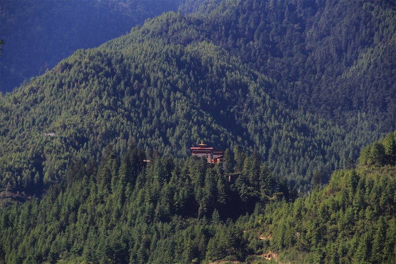
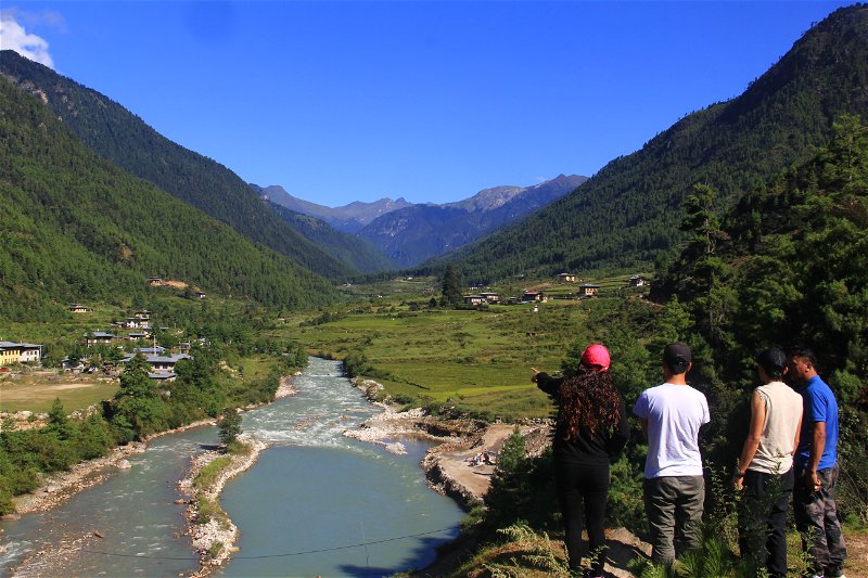
Gallery


Itinerary
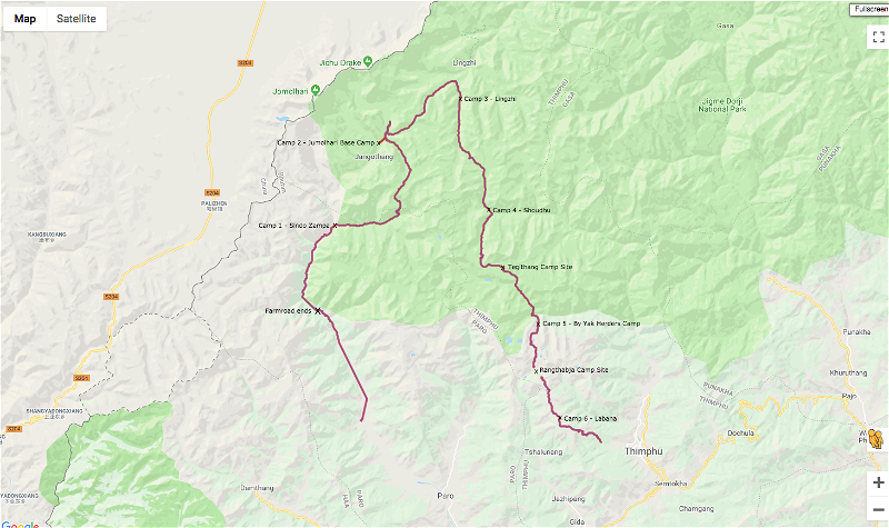
Route Map of "Trekking with the Marmot"
Start - Paro
End - Thimphu
Number of Days - 8 days
Day 1: Drugyel Frotress to Sharna to Sindo Zampa
Distance – 12.8 Km, Elevation Gain – 1,074 m, Approximate walking time – 6 Hr 30 mins.
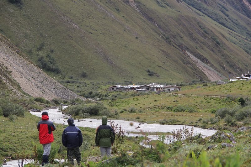
About one hour 20 minutes drive on the farm road from Drugyel Fortress, you will reach Sharna, a quint little village with 10 plus houses. A little down the valley a turquoise colored stream flow peacefully with yellow rice field on both sides.
Sharna is the entry point to Jigme Dorji Wangchuck National park known as the valley of Snow Leopards.
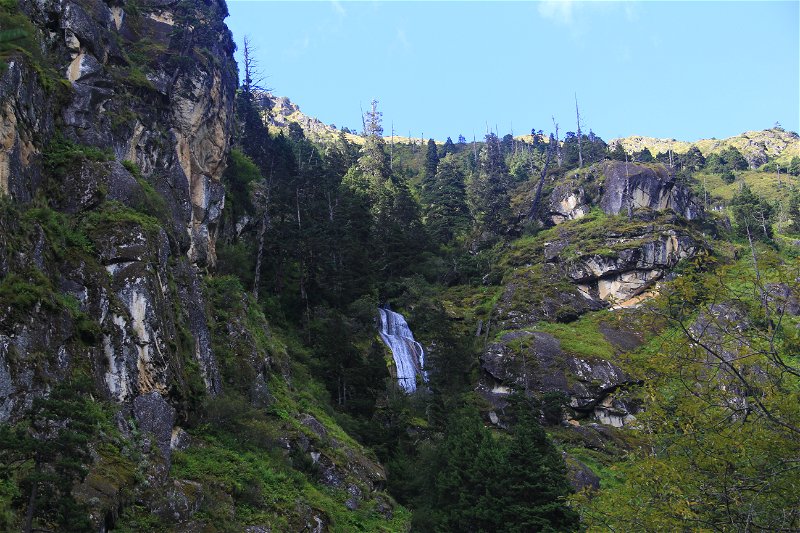
The climb is gentle through the moist conifer to dry conifer vegetation. After crossing as many as 8 wooden bridges under which fresh glacial river flow, you will reach the campsite around 4 in the evening.
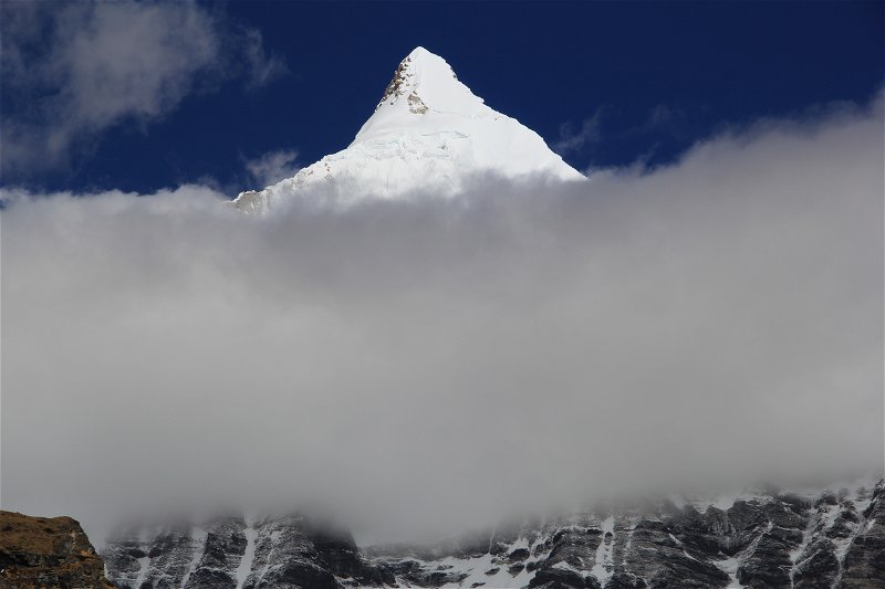
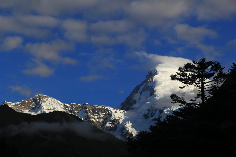
The campsite has the beautiful west view of Mt. Jumlohari.
Day 2: Sindo Zam to Jangothang
Distance – 22.9 Km, Elevation Gain – 1,725 m, Approximate walking time – 11 Hr 30 mins.
It’s the hardest day of the trek crossing 4900 m high Bonteyla Pass. The trail will lead to grassland, beautiful meadow and as you ascend to the pass, one can see the beautiful view of the peak of younger mountains down below.
If this is more challenging than expected, you can camp a little below Yelela Pass by the fresh stream with the east view of Mt. Jumolhari and Mt. Jichu Drakey.
You will come across yak herders house, yaks, and blue sheep.
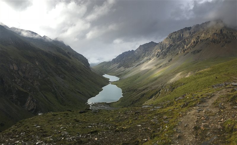
The scenic beauty of Tsho Phu, a two twin like Mountain Lake at an altitude of 4430 m with majestic tall bare cliff on either side is a treat and will boost your energy.
You will reach your campsite around 7 in the evening.
Day 3: Jangothang Day Excursion
Enjoy your breakfast of your choice at Jangothang, the base of snowcapped beautiful Mt. Jumolhari (7,314 meters (23,996 ft) above sea level). Visit a primary school and interact with students located a few km away from your campsite. 2 hours hike towards the Mt. Jumolhari and the view of gigantic snow capped mountain will exhilarate your senses.
Enjoy the visit to nearby Jangothang village, yak herders house and take photograph of some of the exotic medicinal Himalayan flowers.
You will be acclimatized and energy regained by the end of the day ready for yet another exciting trek the next day.
Day 4: Jangothang to Lingzhi
Distance – 20.10 Km, Elevation Gain – 1,167 m, Approximate walking time – 8 Hrs. 30 mins.
The first 1-hour is the steep climb and then a gentle rise along the beautiful vast grassland and patches of yellow meadow. The rare and legendary Raven, the national bird of Bhutan and numerous group of marmots sprouting from the ground, blue sheep and red fox are seen here.
You need to cross Nyela Pass (4865 masl), cold with skin biting wind so you need to put on some face and head cover with some warm wraps. Below the pass, there are abundant presence of Picrorhiza kurroa, the rhizome of which has long history of use in Ayurvedic medicine.
As you reach the campsite, enjoy the view of snowcapped Jichu Drakey towering right in front of you.
You will reach at the campsite around 5 in the evening.
Day 5: Lingzhi to Shodhu
Distance – 16.17 Km, Elevation Gain – 882 m, Approximate walking time – 6 Hrs. 30 mins.
The highest point for this day is Yelela Pass (4911m) with cold bone eating wind on the top but a gradual descend after the pass is the beautiful but huge mountain lake, blue in color and sprouting with fishes.
After this is an easy descend crossing as many as 6 wooden bridges, marmots passing by playing hide and seek with each other and herd of blue sheep enjoying the fresh highland grass.
If you find Shodhu camp site little marshy, plain and nothing of interest and if your legs has some energy walk a little further, about 1 and half hour and camp at Waleythang, a wide open plain between the two giant Himalayan mountains.
You will reach at the campsite around 5 in the evening.
Day 6: Shodhu – Waleythang – Tegithang
Distance – 12.20 Km, Elevation Gain – 813 m, Approximate walking time – 5 Hrs. 30 mins.
Today is an easy with a leisure walk of around 5 hours. A walk along the wide-open plains of Waleythang, with yaks around and yak herders houses with smoke rising from the roof is the sight you will enjoy.
The highest point is Legila Pass with 4747 meters above.
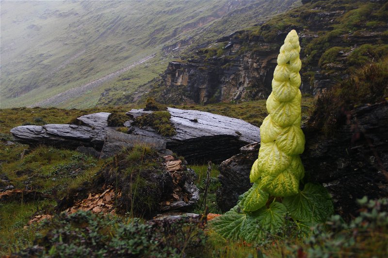
A numerous Rheum Nobile a giant herbaceous plant with conical tower of delicate, straw-colored, shining, translucent, overlapping bracts dots the mountains and gorgeous cliffs.
Your campsite is at the beautiful wide open valley of Tegethang and will reach there around 3 in the evening.
Day 7: Tegithang – Rangthabja
Distance – 17.60 Km, Elevation Gain – 583 m, Approximate walking time – 7 Hrs. 40 mins.
The highest point for the day is Shachumla Pass (4426 masl) and is also a haven of 3 huge beautiful mountain lakes.
The trek is on a gentle slope with different species of rhododendrons flowers beautifying the area.
Your campsite is the only area in Bhutan that has abundant exotic yellow poppy flowers and it will be in full bloom around April – May.
Day 8: Rangthabja to Labana to Motithang to Thimphu
Distance – 16.30 Km, Elevation Gain – 433 m, Approximate walking time – 7 Hrs. 30 mins.
Last day of the trek where the highest point to cross is Labana Pass (4215 masl). From the pass you will have the last glance of Mt. Jumolhari on one side and Mt. Gangkarpunsum and other eastern Himalayan mountains on the other side.
Alternately, you can camp at Labana, enjoy the spectacular sun set and sun rise arising from the clouds beneath.
Hot tea and snacks will await you at the road point with your car. Around 30 minutes in car, you will then reach your hotel in Thimphu.
Rates
Starting Price - USD 2,075.00 Per Person
(A Max of 10 in a group and Min of 3)
Single Supplement - USD 20
Month Vs Trek with the Marmot
Good for month - April, May, Sept, Oct
Moderate for month - March, June and Nov
Not Good for month - Jan, Feb, July, Aug, Dec
Details
Duration: 8 days 7 nights
Start Location: Paro, Bhutan
Dress: Formal and Casual, Proper Trekking Shoes, sneaker or walking shoes, warm clothes
Fitness Level: Level 5 Challenging: Full day packed itinerary at a challenging pace, with long travel days or trekking for 7-8 hours a day for consecutive days and a demanding/challenging daily schedule of physical activities
Pack: Sunglass, Camera,Thermals and Warm clothes and water
Share This Page